A rare meteorological situation is unfolding across Chicagoland.
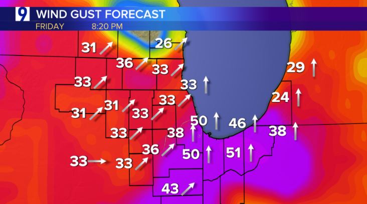
The National Weather Service has issued a Dust Storm Warning for several counties in Northeast Illinois and Northwest Indiana until 8:30 p.m.
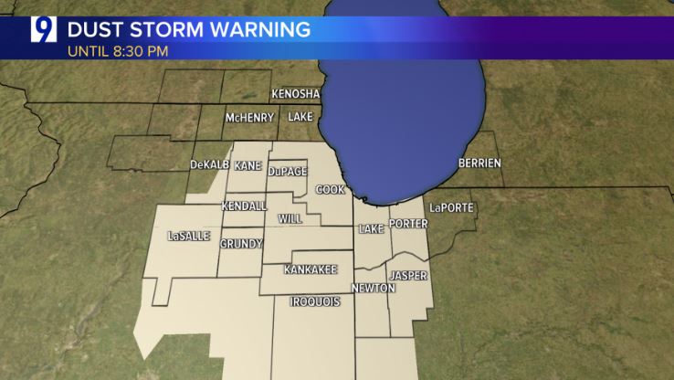
A combination of low relative humidity, very dry conditions and strong winds exceeding 50 mph is creating a wall of dust which has lowered visibility to less than a half of mile.
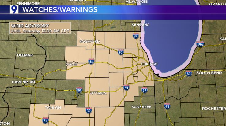
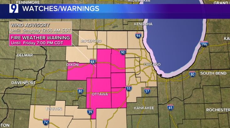
Earlier, the National Weather Service issued a Wind Advisory and a Red Flag or ‘Fire Weather Warning’ for several counties in northeast Illinois.
According to the NWS, a Red Flag Warning means that critical fire weather conditions are either occurring now, or will shortly. A combination of strong winds, low relative humidity, and warm temperatures can contribute to extreme fire behavior.
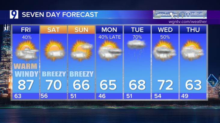
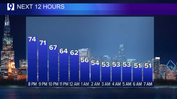
The watch and warnings come on the heels of another very warm, summerlike day Friday, albeit with much less humidity compared to Thursday.
The day opened with plenty of sunshine, but clouds filled in during the afternoon amid a gusty southwest wind.
We’re watching the possibility of Isolated thunderstorms that may “bubble up” in the unstable atmosphere. A few storms could be borderline severe, especially south and east of Chicago with hail and gusty winds being the biggest threats. A much greater risk for severe weather will occur well south of Chicago.
Looking Ahead
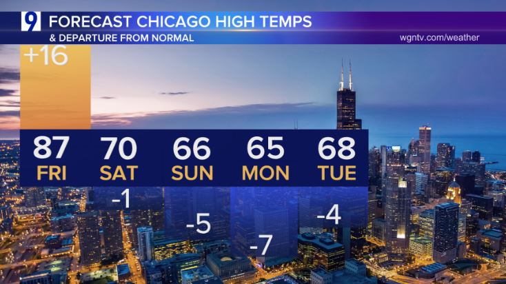
Summerlike heat moves out, and far cooler conditions take hold for the foreseeable future beginning this weekend.
Jet stream winds by mid-next week shift northwest as a digging trough out of Canada brings much cooler, unsettled weather at times.
The forecast highs for the next five days and their departure from normal:
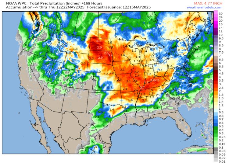
The forecast tracks more wet weather in the coming days, especially early next week
Total potential rainfall the next 7 days
Healthy rainfall amounts across the corn belt, Midwest and Great Lakes with beneficial 1-2” rainfall tallies likely
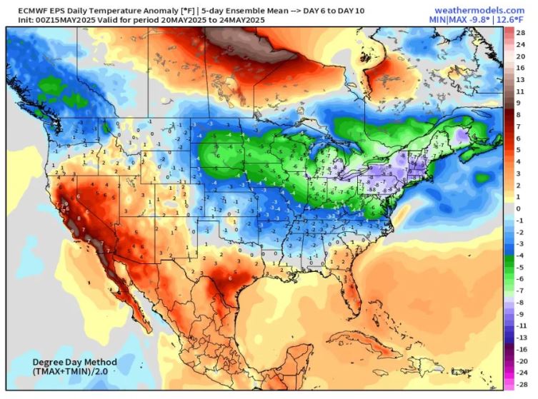
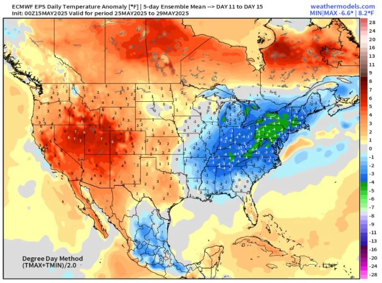
An unseasonably cool pattern takes shape for the Midwest and Northeast for the final 10 days of May 15, 2025
Forecast average full-day temperature departure from normal May 20 through 24:
Forecast average full-day temperature departure from normal May 25 through 29:
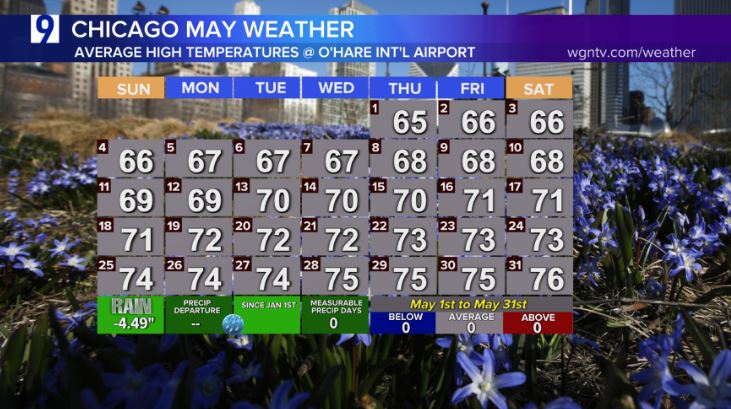
May’s warming trend